
Appearance
Points of Interest (POI) Categories
Quick Answer
POIs are businesses and places shown on the Google Maps base layer. You can toggle POI visibility by category in the Base Map tab to reduce clutter or focus on specific types.
What Are POIs?
Points of Interest are places displayed by Google Maps on the base map layer, separate from your project locations. These include businesses, parks, schools, and other landmarks that provide geographic context.
Important: POIs are different from your site data:
- Your Sites: Shown as colored markers (existing, proposed)
- Layer Sites: Competitor/external data you've loaded
- POIs: Google's base map data (restaurants, stores, parks, etc.)
Available POI Categories
Zeus.ai allows you to toggle these POI categories:
| Category | Icon | What It Shows |
|---|---|---|
| All POIs | Master toggle | Show/hide all categories at once |
| Businesses | 🏢 | Stores, restaurants, gas stations, commercial businesses |
| Parks | 🌳 | Parks, recreational areas, green spaces |
| Healthcare | 🏥 | Hospitals, clinics, pharmacies, healthcare facilities |
| Government | 🏛️ | Government buildings, civic centers, post offices |
| Attractions | 🎢 | Tourist attractions, landmarks, museums |
| Schools | 🏫 | Schools, universities, educational institutions |
| Worship | ⛪ | Churches, mosques, temples, synagogues |
How to Control POI Visibility
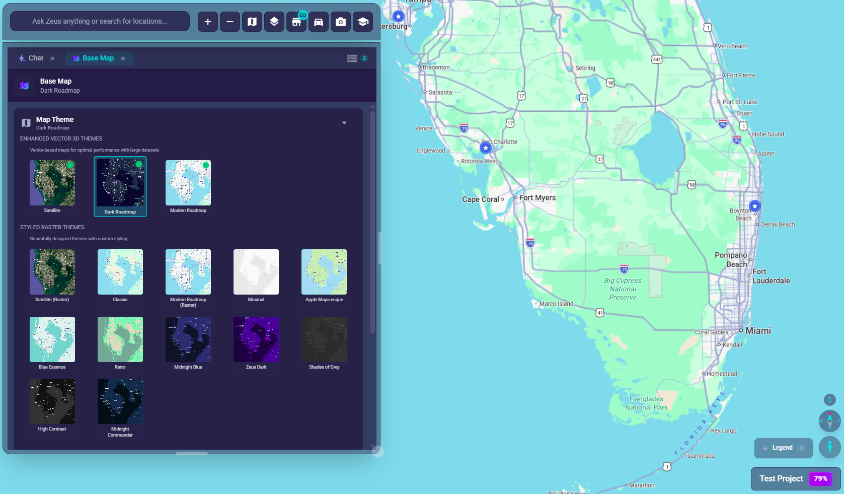
Step 1: Open Base Map
- Click the Base Map button (
map🗺️) in the chat bar at bottom-left
Step 2: Find POI Controls
- Scroll down past Map Theme to the "Map Features" section
- Look for "Points of Interest" subsection
- You'll see checkboxes for each category
Step 3: Toggle Categories
- Check/uncheck individual categories to show/hide
- Use "All POIs" master toggle to quickly show/hide everything
- Changes apply immediately to the map
Using the Master Toggle
- All checked: Click "All POIs" to uncheck all
- Some checked: Click "All POIs" shows partial state (indeterminate)
- None checked: Click "All POIs" to check all
Vector Map Note
⚠️ Important: POI category controls are only available on Raster map themes.
If you're using a Vector theme (Dark Roadmap, Satellite Vector):
- POI controls will be disabled/grayed out
- Vector maps use cloud-based styling that doesn't support local POI filtering
- Traffic, Transit, and Bicycle layers still work on Vector themes
To use POI controls: Switch to a Raster theme like Classic, Satellite (Raster), or Modern Roadmap (Raster).
Using POIs for Analysis
Site Selection Context
- See what businesses are near a proposed location
- Identify anchor retailers (major stores, restaurants)
- Spot gaps in the market
Competition Awareness
- Enable Business category to see commercial density
- Identify areas with high retail activity
- Understand the competitive landscape
Co-Tenancy Analysis
- Which businesses locate together?
- Successful retail combinations
- Traffic generators near your sites
Demographic Signals
- School density indicates family neighborhoods
- Medical facilities suggest older demographics
- Attractions indicate tourist areas
Best Practices
For Quick Analysis
- Start with All POIs off for clean view
- Enable Businesses to see commercial context
- Add other categories as needed for specific analysis
For Clean Presentations
- Turn off most/all POIs
- Focus on your location markers
- Less clutter for stakeholder viewing
For Dense Urban Areas
- POIs can overcrowd the map
- Enable only the most relevant category
- Zoom in for detail when needed
POI Display Behavior
At Different Zoom Levels
| Zoom Level | POI Display |
|---|---|
| Zoomed out | Major landmarks only |
| Medium zoom | More businesses appear |
| Zoomed in | Full POI detail with labels |
Icons vs Labels
- Icons: Small markers for businesses
- Labels: Text names appear at higher zoom
- Both controlled by the category toggles
Map Elements (Related Controls)
In addition to POIs, the Base Map tab offers Map Elements toggles:
| Element | What It Controls |
|---|---|
| Roads | Highways and local roads (each with its own sub-toggle) |
| Water | Rivers, lakes, ocean fills |
| Road Labels | Street names |
| Place Labels | Named places on the map |
| Map Icons | Small icon glyphs on the base layer |
| Parks | Park area fills/shading |
| Transit Labels | Bus/train/subway stop and line names |
And additional controls:
- Boundaries: Country/state borders
- Terrain Features: Natural land features (hills, forests)
Note: These are also only available on Raster themes, not Vector themes.
Troubleshooting
POI Controls Grayed Out
- You're on a Vector theme
- Switch to a Raster theme to enable controls
POIs Not Showing
- Check if category is enabled (checkbox checked)
- Zoom in - POIs appear more at closer zoom
- Data may not exist for very rural regions
Wrong Category
- POIs are auto-categorized by Google
- Some businesses may be miscategorized
- Use search for specific businesses if needed
Too Cluttered
- Turn off extra categories
- Zoom in to spread out POIs
- Use Smart Clustering for your own markers
Performance Impact
- Many POI categories = more to render
- Disable unused categories for better performance
- Combine with clustering for best results